- Subject
- Print Collection
- Item type
- Object
- Primary inscriptions
- Map of the British Isles with Geological Boundaries for the use of students. Compiled from the latest available data by F. Smithson, Ph.D, F.G.S. December 1931.
- Object type
- Dimensions
- Height: 311mm Width: 262mm
- Inventory No
- 13732
Related Items
More related items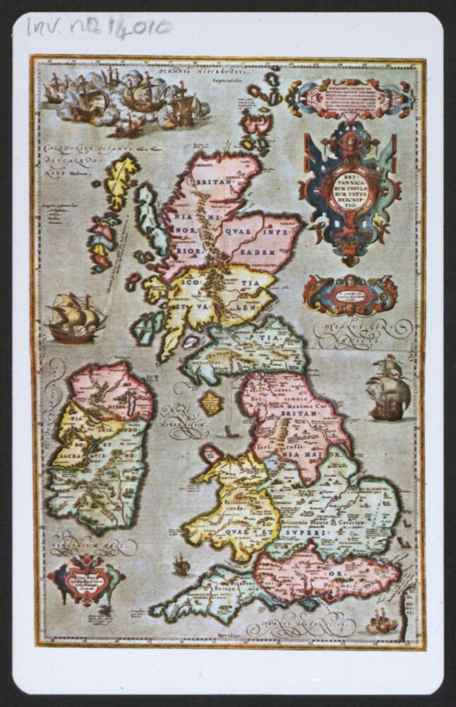 Print, Trade Card for the Baynton-Williams Gallery with reproduction map of the British Isles, London, 21st CenturyInventory Number 14010
- Print (Poster) Photographic Map of the Moon, Russia, 1967Inventory Number 14517
- Print (Newspaper) The Times, Great Western Railway Centenary Number, London, 1935Inventory Number 14112
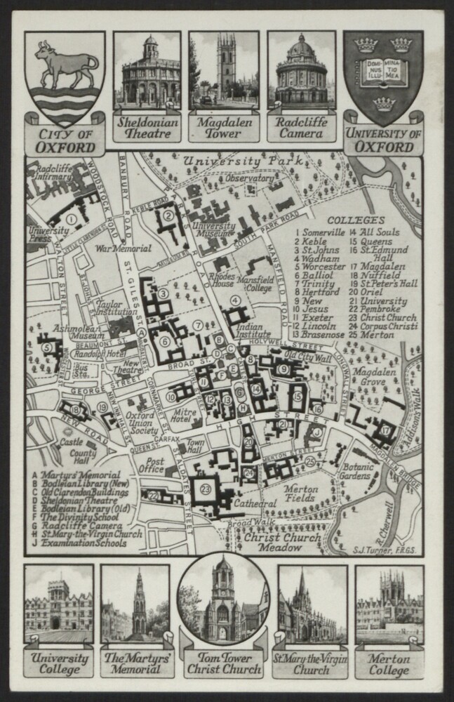 Print (Postcard) Map of City of Oxford with University Colleges, 20th CenturyInventory Number 13888