- Subject
- Print Collection
- Item type
- Object
- Makers
- Benjamin Martin
- Provenance
- Radcliffe Observatory Collection, Oxford.
- Primary inscriptions
- The Geography of the Transit of Venus Explained. The Astronomical Uses of this Transit are to determine the Sun's Horizontal Parallax and Distance from the Earth. From whence the Distances of all the Planets and Comets from the Sun will be ascertained to the Greatest Exactness that can ever the Expected. Published according to the Act of Parliament. September 1st 1760 by B. Martin.
- Physical material
- Laid paper
- Physical medium
- Black ink
- Physical technique
- Engraving
- Object type
- Dimensions
- Height: 508mm Width: 391mm
- Inventory No
- 14375
Description
Martin explains the visibility of the transit of 1761 by giving three views of the earth, showing the hemisphere facing the sun at the beginning, middle and end of the transit. This is the only known surviving copy of his print.
There was much discussion before the 18th-century transits of the best places from which to make observations. Several authors compiled maps to help in the decision-making process.
This sheet has a more didactic and popular purpose. It is intended to explain the visibility of a transit, and shows three views of the Earth at different moments during the transit of 1761. The views represent the face of the Earth illuminated by the Sun at the beginning, middle and end of the transit. By inspection it is possible to estimate how much of the transit will be visible at any particular place.
Related Items
More related items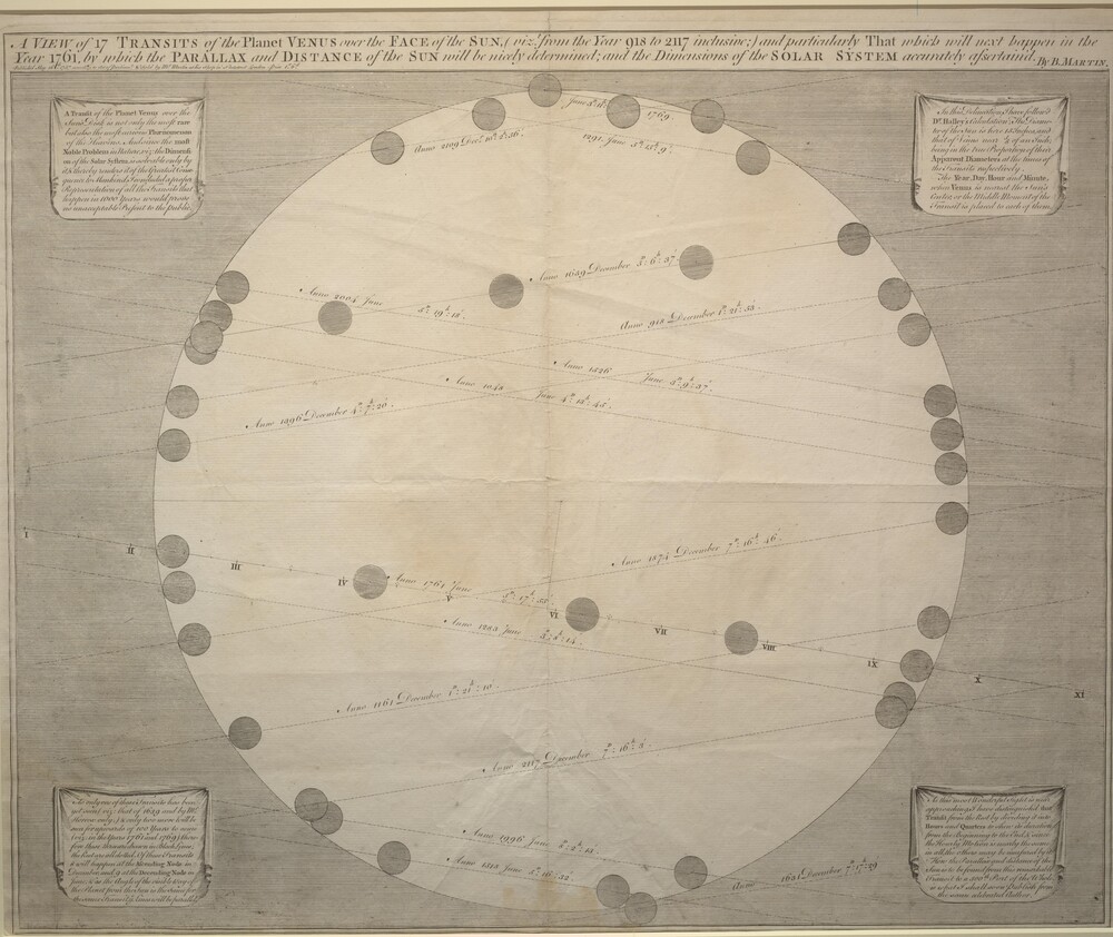 Print (Engraving, Framed) Entitled "A View of 17 Transits of the Planet Venus", by Benjamin Martin, London, 1757Inventory Number 11827
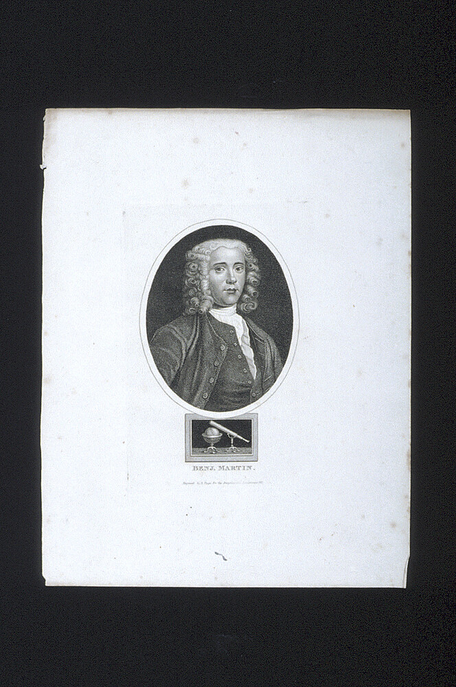 Print (Engraving) of Benjamin Martin, by R. Page, London, 1815Inventory Number 50513
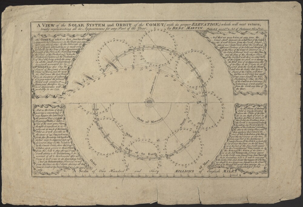 Print (Broadside) A View of the Solar System and Orbit of the Comet with its proper Elevation, by Benjamin Martin, London, 1757Inventory Number 14316
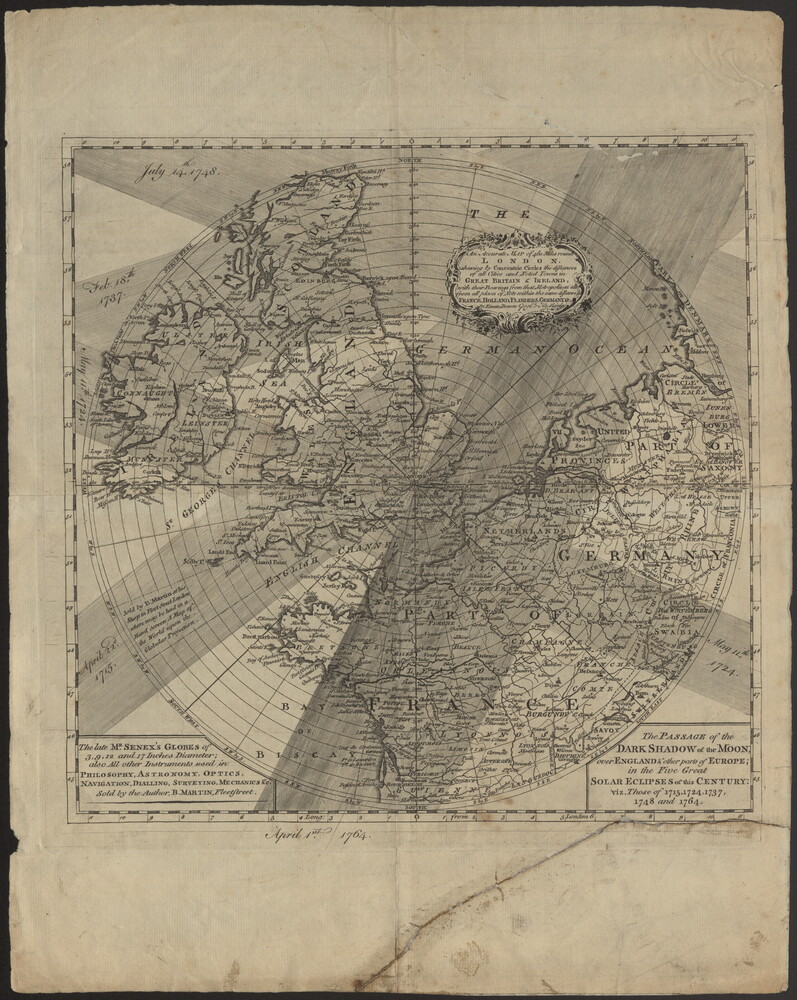 Print of Five Solar Eclipse Paths across North Western Europe, by Benjamin Martin, London, c. 1764?Inventory Number 22214